Increasing the mode share of bicycles is regarded as a solution to mitigate car-induced, urban problems, such as congestions, noise emission, pollution, etc. In order to come up with evidence-based planning processes and decisions, the “where” and “when” cyclists are on the road need be quantified.
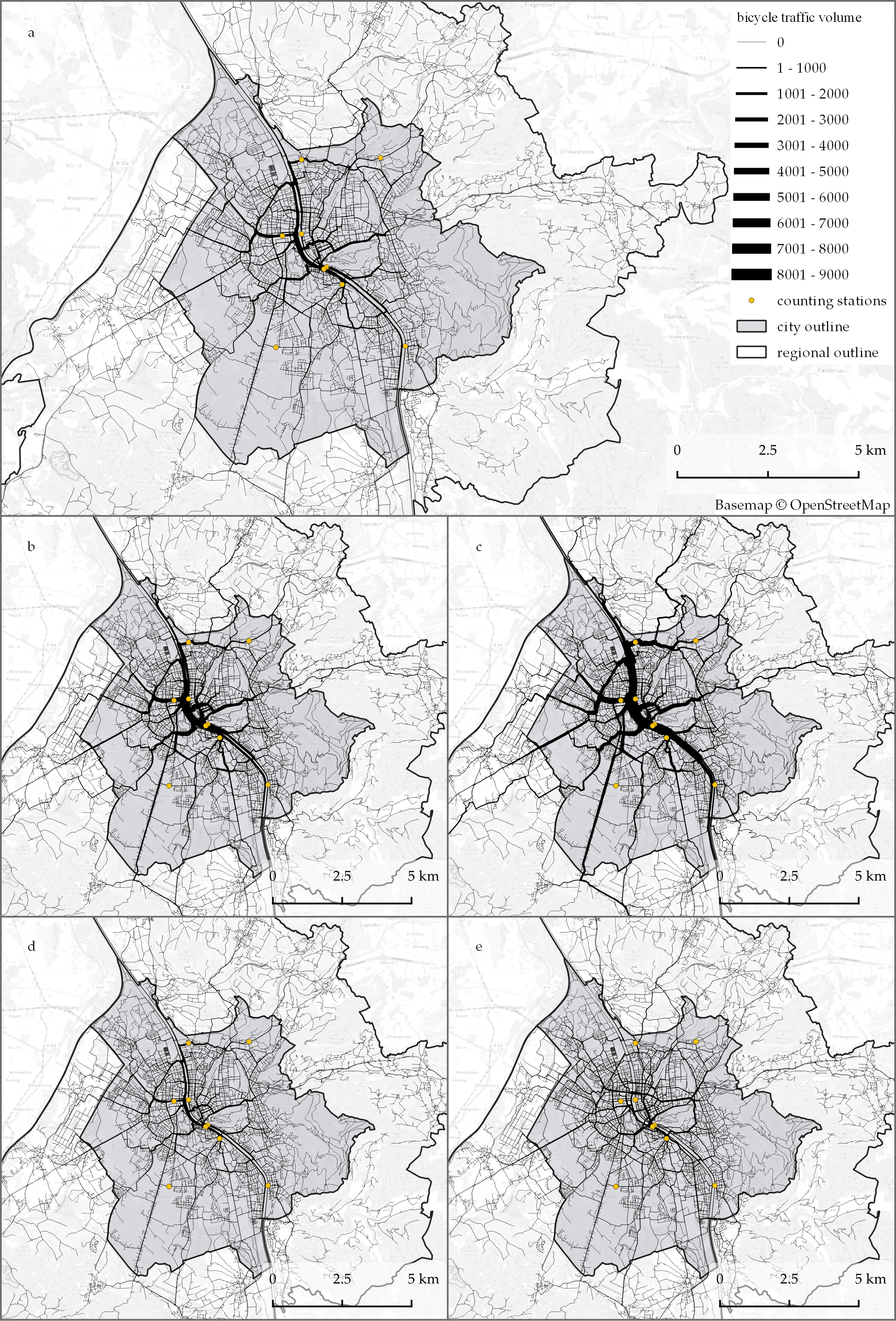
Bicycle traffic volumes of one simulation day in scenarios.
Within the FamoS project, we developed an agent-based model to simulate spatially and temporarily disaggregated traffic flows of cyclists in the greater region of Salzburg over one day. For modeling, we use demographic data on residency and employment, mobility survey data, data describing the environment, such as points of interest and a road network. The model simulates the decision-making of every individual resident to dynamically select activities and trips in response to their preferences. The bicycle model is developed in the GAMA modeling platform (Taillandier et.al. 2019) and available at the CoMSES Net library.
We carried out a scenario analysis to evaluate the complexity of the model, where we checked implemented mobility concepts against null models, such as random activity type choice, unrestricted target location choice, random starting time choice, and shortest path route choice. As an example, the figure on the right shows the different spatial distributions of cyclists over a day in each scenario.
The model results were validated against GPS tracks obtained from the Bike Citizens app and Strava app. We found strong temporal correlations and moderate to weak spatial correlations. The description of the methodology and the discussion about the strengths, limitations, and possible improvements of the bicycle model can be found in a recent publication by Kaziyeva et.al 2021:
Kaziyeva D, Loidl M, Wallentin G. Simulating Spatio-Temporal Patterns of Bicycle Flows with an Agent-Based Model. ISPRS International Journal of Geo-Information. 2021; 10(2):88. https://doi.org/10.3390/ijgi10020088
Leave A Comment